Landsat 9 Sees Buccaneer Archipelago
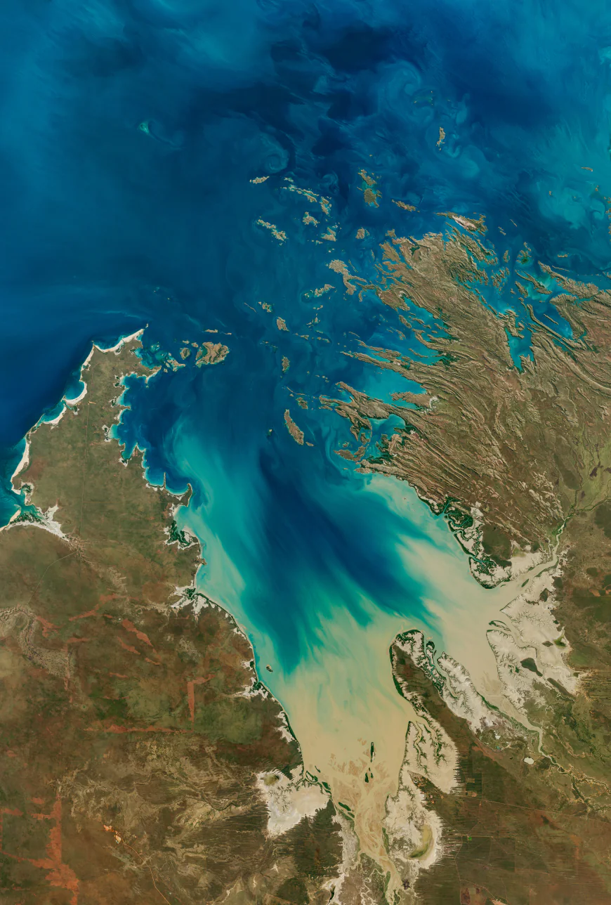

The Operational Land Imager on Landsat 9 captured this image of Buccaneer Archipelago on June 11, 2025. The scene encapsulates the striking interactions between land and water in the area where King Sound opens to the Indian Ocean.
The powerful tidal currents stir up sediment in shallow areas, producing the beautiful turquoise swirls visible in this image. This power, however, can be hazardous to seafarers and divers as water rips through the archipelago’s constricted passages. One infamous place of turbulence, known as “Hell’s Gate,” lies in the passage between Gerald Peninsula and Muddle Islands.
Learn more about this archipelago in Western Australia.
Text credit: Kathryn Hansen
Image credit: NASA/Michala Garrison; U.S. Geological Survey
What's Your Reaction?
 Like
0
 Dislike
0
 Love
0
 Funny
0
 Angry
0
 Sad
0
Sad
0
 Wow
0
Wow
0


